Spring is in swing…Dodger baseball is back, the hills are green, the wildflowers are in bloom and the rains are gone…well, not exactly quite yet. But at least we’re going to have a dry weekend at long last, perfect for our second CicLAvia of 2024 (and 51st evar) this Sunday.
Venice Boulevard is one of Los Angeles’ landmark thoroughfares, running 13 miles in length from Main Street in Downtown to the Speedway in Venice Beach. It is the only street entirely within the City of Los Angeles that runs directly from Downtown to the Pacific Ocean. It is also one of the City’s widest streets at 175 feet in breadth. Established in 1905 as part of Abbot Kinney’s (we’ll explore that name later) Venice of America development, it grew around an electric railway line that was built in 1896. It gradually expanded eastward towards Crenshaw Boulevard in Mid-City, and in 1932, West 16th Street between Crenshaw Boulevard and Main Street was re-named Venice Boulevard.
This Sunday’s 5.8-mile CicLAvia route running mostly along Venice Boulevard is not exactly new, as this is actually a truncated version of the epic, ambitious 15-mile CicLAvia To The Sea route 11 years ago to the day, on April 21, 2013, which shares the alignment from National Boulevard on west. Since then, there have been five other CicLAvias that have incorporated Venice Boulevard – August 2015 (Culver City Meets Venice), March 2017 (Culver City Meets Venice), March 2019 (Culver City Meets Mar Vista + Palms), June 2019 (Mid-City Meets Pico-Union) and April 2023 (Mid-City Meets Pico-Union). What’s also notable is that this route is the de facto re-scheduling of the planned April 26, 2020 Mid-City Meets Venice CicLAvia that was obviously canceled due to El Pandemic. We were all sheltering in place binge-watching Netflix and getting our groceries delivered (if we were lucky enough not to catch COVID, of course). That one was supposed to run a nearly-identical route, with the exception of being extended farther west to San Vicente Boulevard.
The Militant, having the dubious distinction of being one of the few Angelenos who have attended all 50 CicLAvias to date, knows this one will get a huge turnout – Basically any CicLAvia that involves 1) Downtown, 2) Hollywood or 3) The Beach will pull a crowd, and this one will generate at least a hundred thousand selfies under the “VENICE” lighted sign at Windward Avenue. It’s been seven years since CicLAvia has hit the beach! So, as usual – see you or not see you on the streets this Sunday!
Oh yeah, if you found this Epic CicLAvia Tour guide useful and visit any of these sites, please add the #EpicCicLAviaTour hashtag to any social media post that includes it. The Militant will be glad to re-tweet!
And if you appreciate The Militant’s work, kick him a little love via PayPal! He *hates* asking for money, but you know how it is these days…A Militant’s gotta pay his bills! He sacrifices a lot of his time to do this, so your support is much appreciated!
To support The Militant Angeleno: https://www.paypal.com/donate/?hosted_button_id=K5XC5AM9G33K8
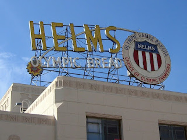
1. Helms Bakery
1931
8758 Venice Blvd, Los Angeles
From 1931 to 1969, Angelenos knew their bread, and it came from blue-and-yellow delivery trucks from the legendary Helms Bakery, founded at this site, with eventual satellite bakeries in Montebello and San Bernardino. It was the official bread of the 1932 Olympic Games here in Los Angeles, and the bread was so renowned, it was provided to the U.S. Olympic teams in subsequent Olympiads. It was even the first bread eaten on The Moon, as part of the Apollo 11 astronauts’ food rations. But you couldn’t buy the bread in any store, it was only from their delivery trucks (yes, the food truck craze is not new round here) with their tell-tale “TOOT! TOOT!” whistle. Ultimately, after an era where people bought food from delivery trucks, the Helms brand succumbed to the rise of the supermarket. This building and its trademark neon sign stand, adaptively reused, as a testament to its history and impact on Southern California. But everything old is new again, and like the legend of the Phoenix, the Helms Bakery plans to re-open …one of these days (we were promised this over a decade ago…).
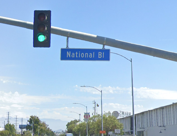
2. National Boulevard
1889
Between Jefferson Boulevard and Bundy Drive, Los Angeles
Established in 1889 when The Westside was literally the boonies, it was intended to be a thoroughfare leading to the Sawtelle Veterans Home, formally named the National Home for Disabled Volunteer Soldiers, Pacific Branch, which opened in 1888. Never heard of either of those places? The care home expanded and evolved and is now known as the VA West Los Angeles Medical Center (which will get its own Metro (D) Line subway station in 2028). It never quite reached the Veterans Home, but you known it today as perhaps one of the most perplexing throughfares in all of Los Angeles with its constant, excessive twists, turns and bends. Alas, our Freeway Culture is to blame: Before the late 1950s, National was a somewhat more straightforward street but was consequently chopped up and made into a crooked mess due to the construction of the Santa Monica Freeway.
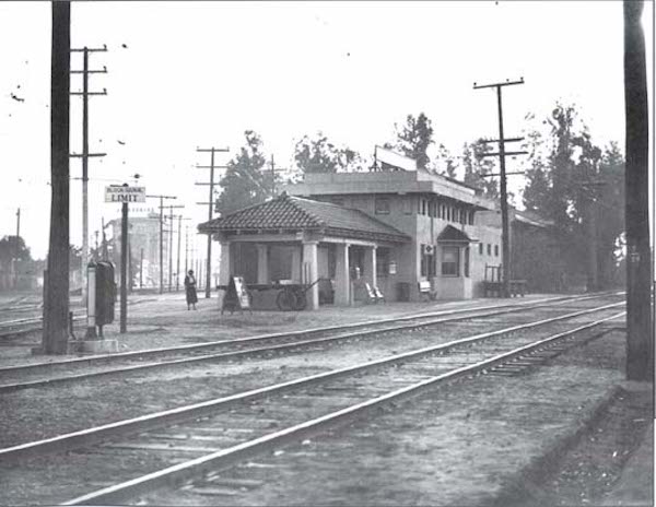
3. Culver City Metro (E) Line Station/Site of Culver Junction
2012
Venice and National boulevards, Culver City
You may or may not have arrived at CicLAvia via the Metro (E) Line, which is the modern reincarnation of the Pacific Electric Santa Monica Air Line. Not only can you experience Los Angeles’ transportation present, but you’re also in the clear presence of its past — this area was also the site of Culver Junction, where not one, not two, but three Pacific Electric Red Car lines converged, going to Santa Monica, Venice and Redondo Beach. TIP: Make sure you buy a Day Pass or that your TAP card is well-loaded before CicLAvia, so you don’t have to queue at the ticket machines! The Militant says “You’re Welcome.”
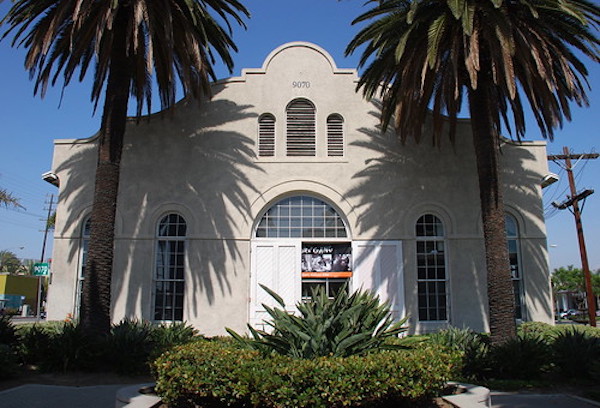
4. Pacific Electric Ivy Substation
1907
Venice and Culver boulevards, Palms
Downtown Culver City is already rich in retail and artistic activity, and has a bevy of well-known eateries, like the popular Father’s Office and Honey’s Kettle Chicken. The Militant can cover that in its own post (and kinda already did before). But welcoming people to Downtown Culver City along Venice Blvd (though technically located in the Los Angeles neighborhood of Palms), a block from the Culver City station is an appropriate link to the past – the Ivy Substation. The single-story Mission Revival-style structure served as a powerhouse for the Pacific Electric Railway from 1907 to 1953, when the Expo Line’s predecessor, the Santa Monica Air Line, ceased operation. Today, it’s a 99-seat venue for The Actor’s Gang theatre company, renovated in the early 1990s. How interesting that a building originally built for transportation infrastructure was repurposed into a building for the arts, which in turn attract people using the new transportation infrastructure.
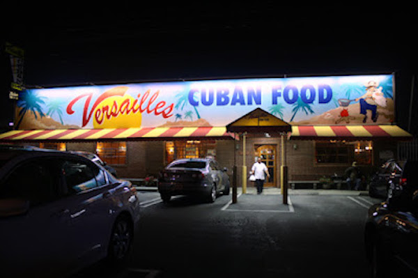
5. Versailles Cuban Restaurant
1981
10319 Venice Blvd, Palms
Home of their legendary garlic chicken and black beans, among other menu items, this restaurant was founded at this location by Cuban immigrant Orlando Garcia in 1981 after opening a restaurant called El Rincon Criollo near Downtown Los Angeles in the 1979. So why is does an iconic Cuban restaurant bear the name of a historic palace in France? Originally to be named “El Rincon Criollo #2,” it was eventually named “Versailles” at the urging of his son and current owner William Garcia, who recalled visiting a fishing village called Versailles during his youth with his father, and stayed at Miami’s Versailles hotel after his own wedding. And during his honeymoon, the cruise ship’s dining room was also called Versailles. So his geographical leitmotif won out. The restaurant, now a local chain, eventually grew to five locations, but three (including locations in Encino and near Beverly Hills) operate today.
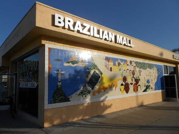
6. Brazilian Mall
c. 1980s
10826 Venice Blvd, Culver City
There may not be a formal “Little Brazil” or a “Brazil Town” (or even a “Historic Brazil Town”) anywhere in Southern California, but this area of Culver City and Palms centered around this stretch of Venice Boulevard is the closest thing. The Brazilian community (many of them consider themselves “expatriates” rather than “immigrants’) in Los Angeles may be an asterisk within our local Latin American demographic (Latino but not Hispanic, as they speak Portuguese), but there’s a healthy community of them who have called the Palms/Culver City area for some 40-50 years, with restaurants, markets and other Brazilian-owned shops along the Venice Blvd corridor between Sepulveda Blvd and Motor Ave. This building at the corner of Venice and Westwood boulevards contains um número of Brazilian-owned businesses, anchored by Supermercado Brazil, perhaps the largest Brazilian market in Southern California (or California, for that matter). Typical of our local ethnic markets, this one also features nearly everything for the homesick, including snack foods, beverages, cooking ingredients (the brands Yoki and Soya are well-represented here), and even CDs/DVDs, flags, t-shirts and – this being Brazil of course – bikinis. Do check out the Brazilian brigadieros (chocolate) or beijinhos (coconut) handmade candies! The Militant blogged about his visit here in 2012! Incidentally, Los Angeles is a Sister City to Salvador, Brazil (though Culver City has no shared urban sorrority with any place in that country).
7. State Route CA 187
1964
Venice Boulevard between Lincoln Blvd and the 10 Freeway
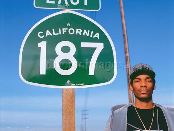
You may or may not know that Venice Boulevard, in addition to being a two-time CicLAvia route, was also a Pacific Electric Red Car line, but did you know it’s also a designated California State Highway? In 1964, CalTrans designated State Route 187 starting at the Pacific Ocean. In 1994, it was shortened to the 5.4 miles from Lincoln Boulevard to the 10 Freeway. The number “187” also happens to be a reference to the California Penal Code designation for murder, which is most likely why a young, ’90s-era, pre-commercialized Snoop Dogg is standing by the sign in this photo.
8. The Oval District/Palm Place
1912
Area within Washington Place, McLaughlin Ave, Venice Blvd & Inglewood Blvd, Mar Vista
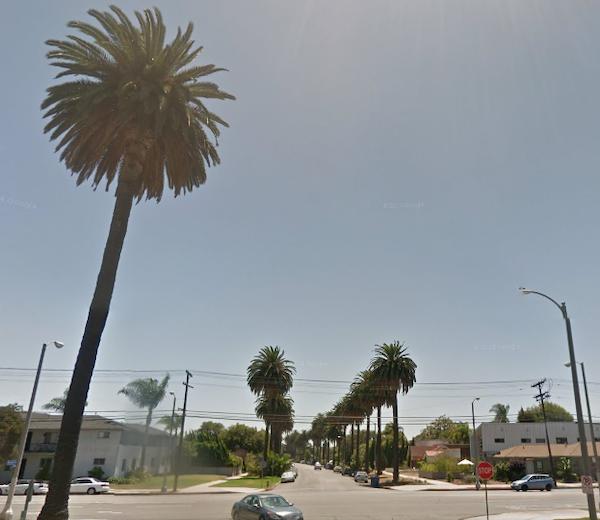
You might not see much from the street level, but this neighborhood just south of the CicLAvia route, a Historic Preservation Overlay Zone known as “The Oval District,” is one of the first automobile-oriented property tract developments in Southern California. When seen from a map or an aerial view. the streets of this 200-unit housing development of predominantly 1- and 2-story homes resembles an hourglass shape with an oval road in the center (which caught The Militant’s eye and caused him to investigate the history of the place). The 137-acre neighborhood was developed in 1912 by a Lillian Charnock Price (there is a “Charnock Road” two blocks north of Venice, BTW) who hired renowned landscape architect and urban planner Wilber David Cook, Jr. (who worked for legendary late 19th/early20th-century landscape architect Frederick Law Olmsted to design an “Aristocratic Suburb” marketed as “Palm Place”). The large-sized lots were unique, and park-like in their large setback from the street and the palm tree-lined parkways, but only a small number of homes were built. Price sold the development to Robert Sheman, who was the stepson of Moses Sherman, the developer of the Los Angeles and Pacific Railway, which built the original rail line on nearby Venice Boulevard. What was originally intended to be the first car-oriented development was going to be a transit-oriented development! But those didn’t sell either. The lots were still too large and pricey. So Sherman sold it to a financier group that marketed it as “Marshall Manor” in 1920 and interest began to pick up. But it wasn’t until after World War II, when suburbanization was in vogue and Los Angeles’ Westside development boom commenced, that the rest of the lots got built.
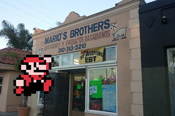
9. Mario’s Brothers Market
12904 Venice Blvd, Mar Vista
No deep history behind this neighborhood Mexican corner market on Venice and Beethoven, but the name caught The Militant’s eye. He’s seen some of you CicLAvians ride in CicLAvia in Mario/Nintendo cosplay, so this would be a perfect photo/selfie opportunity. While you’re here, support the business and buy something inside. Maybe it really is owned by a Mario. Or a Luigi. Ask where The Princess is. If they’re successful enough, they might move to a larger location and rename themselves “Super Mario’s Brothers.” Tweet a pic of yourself (or your group) in front of Mario’s Brothers with the hashtag “#EpicCicLAviaTour”!
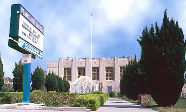
10. Venice High School
1920
13000 Venice Blvd, Venice
Venice’s namesake secondary school was one of three on-location sites for Rydell High in the 1978 motion picture Grease, and was the school scene in the Britney Spears video for her debut hit, “…Baby One More Time.” The main Moderne-style school buildings, built in 1935-37 were designed by local architects John C. Austin and Frederick M. Ashley, who also designed the Griffith Observatory. The campus is also famous for its statue of legendary Hollywood actress and famous alumna Myrna Loy at the front of the school. Other famous alumni include Beau Bridges, Crispin Glover, the late Ivory Queen of Soul, Teena Marie and In-N-Out Burger founder Harry Snyder. Go Gondoliers!
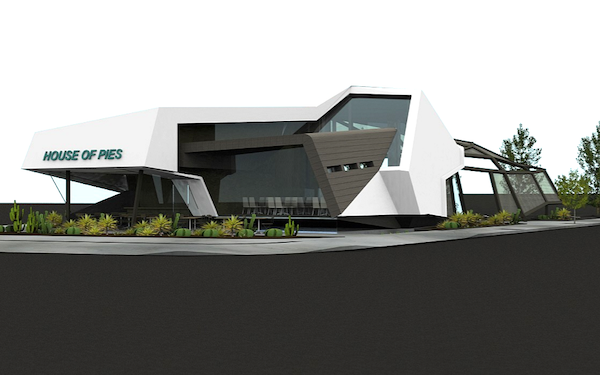
11. Site of House of Pies – Venice
2024?
1020 Venice Blvd, Venice
Every community has one – a building or project that seemingly takes for-ever to build – and is still under construction, loooong past its original opening date. DTLA has the infamous Oceanwide Plaza, a.k.a. The Graffiti Towers. East Hollywood has the Thai Town Marketplace. And in Venice, it’s House of Pies. This long-awaited (re-) expansion of the iconic Los Feliz diner-slash-pie-shop chain was originally supposed to happen before El Pandemic, but obviously its opening was pushed back. Sure, fine. But what was originally supposed to open in November 2022 has been delayed yet again, partially due to a hullabaloo related to the removal of a number of 30+ year-old sycamore trees on the property. It may or may not open in September of this year. Don’t hold your breath.
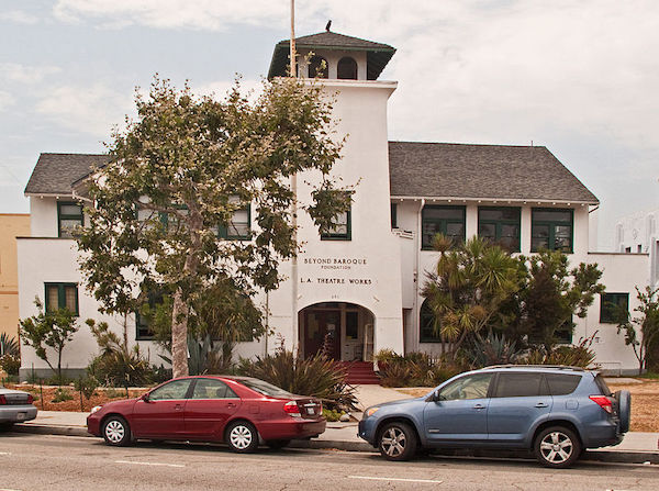
12. Old Venice Civic Center
1911
681-685 Venice Blvd, Venice
Venice, originally founded as part of Santa Monica, seceded from that city in 1911 and for the next 15 years, functioned as an incorporated city. In 1926, due to political mismanagement and crumbling infrastructure, it was annexed into the City of Los Angeles. Its vestigial remnants of its civic government still remain, though. The old Venice City Hall still stands at 685 Venice Blvd (pictured), now the venue for Beyond Baroque Theatre. Next door on 681 Venice Blvd is the old Venice Police Station, now the home of the Social Public Arts Resource Center (SPARC), the community arts nonprofit that spearheaded the modern urban mural movement. It’s interesting to note that both of these government buildings were adaptively re-used for arts purposes. The Militant is looking at the old LAPD Parker Center in DTLA and wonders if it could make some sort of badass performing arts venue…
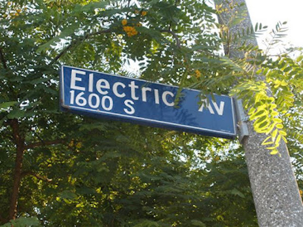
13. Electric Avenue
1905
Electric Ave and Venice Blvd, Venice
No, ’80s singer Eddy Grant didn’t rock down to this street to take it higher (VROOOM!) But this street was so-named because it was one of the old Pacific Electric Red Car rights-of-way, which included Pacific Avenue (of course) and Venice Blvd. The railway, of course, was built to serve (and sell property in and around) Abbot Kinney’s Venice of America development. Rock on to Electric Avenue towards Brooks Avenue and look to your left for actual remnants of Pacific Electric tracks at Millwood Avenue, Westminster Avenue and Broadway. If that kind of stuff excites you, check out The Militant’s Pacific Electric Archaeology Map. And then we take it higher (Oh yeah)!
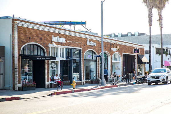
14. Abbot Kinney Blvd
1992
Abbot Kinney Blvd between Washington Blvd and Main Street
New arrivals to Los Angeles are likely oblivious to the fact that Venice’s upscale arts and boutique corridor is technically one of its newest streets. Until 1992, that stretch was confusingly known as West Washington Blvd, which, along with Washington Street and Washington Way, was a source of disorientation among motorists. A small group of business owners lobbied to re-name the stretch after the community’s founder. Ignorance of local history was so bad back then, that then-City Councilman Zev Yaroslavsky, who grew up in the Westside, asked aloud at a Los Angeles City Council committee meeting, “Who is Abbot Kinney?” (Really, Zev?!?!) Thankfully, due to a street name change, and other things, we’re a lot better at our Los Angeles history.
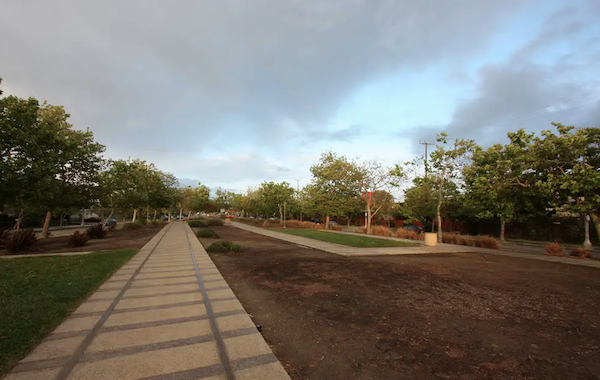
15. Venice Of America Centennial Park
2005
Venice & Abbot Kinney boulevards
This park, which neighbors the Venice-Abbot Kinney Memorial Branch Library and built for Venice’s centennial year of 2005, was made on the very same median that carried the Pacific Electric Railway tracks, and in honor of that, the design on the park’s paving resembles that of railroad tracks. The Militant went there in a famous bike ride to Venice Beach in 2008 and encountered a bunch of ducks walking in this park.
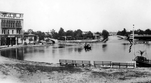
16. Venice Traffic Circle and the Lost Canals
1929
Grand and Windward avenues, Venice
Traffic circles, or “roundabouts” as they’re known in Britain, are not a common sight in the US, much less Los Angeles, though a dozen or so are known to exist here (more in a future post). So what up with this one? This part of Venice was part of Abbot Kinney’s original “Venice of America,” replete with its own canals. But unlike their Italian counterpart, these canals were not physically connected to the ocean, and the water had gone stagnant and kinda gross. By the 1920s, the Venice city infrastructure was falling apart (which meant little resources or political will to maintain the canals), and the automobile had started to conquer the streets of the Southland. So they were filled in circa 1929. The CicLAvia course on Grand Boulevard was once the Grand Canal, and the traffic circle was formerly the location of a large saltwater swimming lagoon. The surviving canals, located south of Venice Blvd, were built by a different developer a couple years after Kinney’s canals opened.
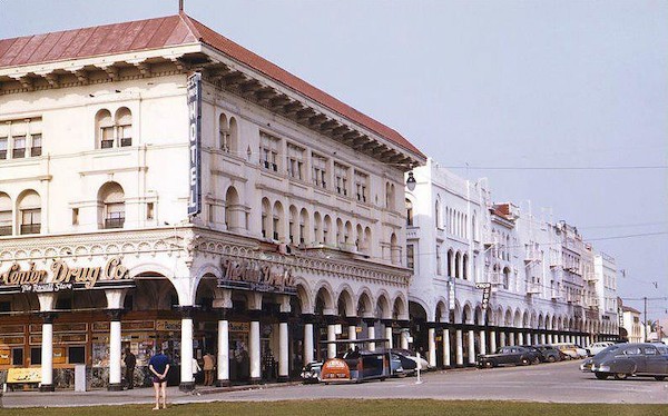
17. Windward Hotel/Pacific Electric Station
1905
Windward and Pacific avenues, Venice
The Windward Hotel, now a traveler’s hostel, is not only the oldest hotel building in Venice, but its eastern ground floor entrance also functioned as Venice’s Pacific Electric station. For the first half of the 20th Century, Venice was a popular western destination for the Red Cars, and the preferred way to go. North of Windward Way, there was no Pacific Avenue, but a dedicated “Trolleyway” for the Red Cars. When passengers disembarked at the Venice station before 1929, they were treated to an awe-inspiring view of the large lagoon (now the traffic circle) and canals just across the street, welcoming them to Venice of America. Now, for CicLAvia, when you arrive here, use your imagination and pretend to be transported back to a time when you didn’t need cars to get around. On this day, it won’t be that hard.

You must be logged in to post a comment.